
Last bike trip: Juune 2012
Cycling the French Riviera (Côte d'Azur):
Along the Mediterranean from Marseille to Cassis, Hyères and Giens, Saint Tropez, Cannes, Antibes, Nice, and Menton.
Bike Rating: Some sections Excellent or Very Good, others Moderate to Poor
Train connections allow skipping poor sections.
Total Distance: 330 kilometers (200 miles)
Difficulty: Mostly easy with some moderate and hard sections
Best Season: June or September, avoid July and August
Nature of the Ride:
This s a ride for sun, sea and resort lovers. It visits a series of red-orange-sienna-colored villages, towns and cities along two-hundred miles of the French Mediterranean coast, with, on one side, olive or ochre-colored hills or mountains, and on the other side, beach after beach bordering smooth sapphire-blue water extending to the horizon under an azure sky dotted with white clouds.
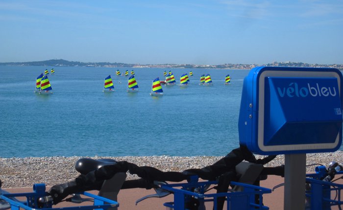
Mediterranean view from Cagnes-sur-Mer, near Nice, towards Antibes:
Idyllic? Not quite! Along the French Riviera don't expect solitude, traffic-free roads, and unsettled countryside. Don't expect empty beaches in July and August, in fact don't visit in July and August — unless you liketo ride in bumper-to-bumper traffic, wait endlessly for restaurant service, reserve all your lodgings far in advance, and lie cheek-by-jowl on the beach.
Come in June for greener vegetation (water temperature about 21ºC-70ºF), or come come during the last few days of August or in September to swim in warmer water (about 24ºC -75ºF).
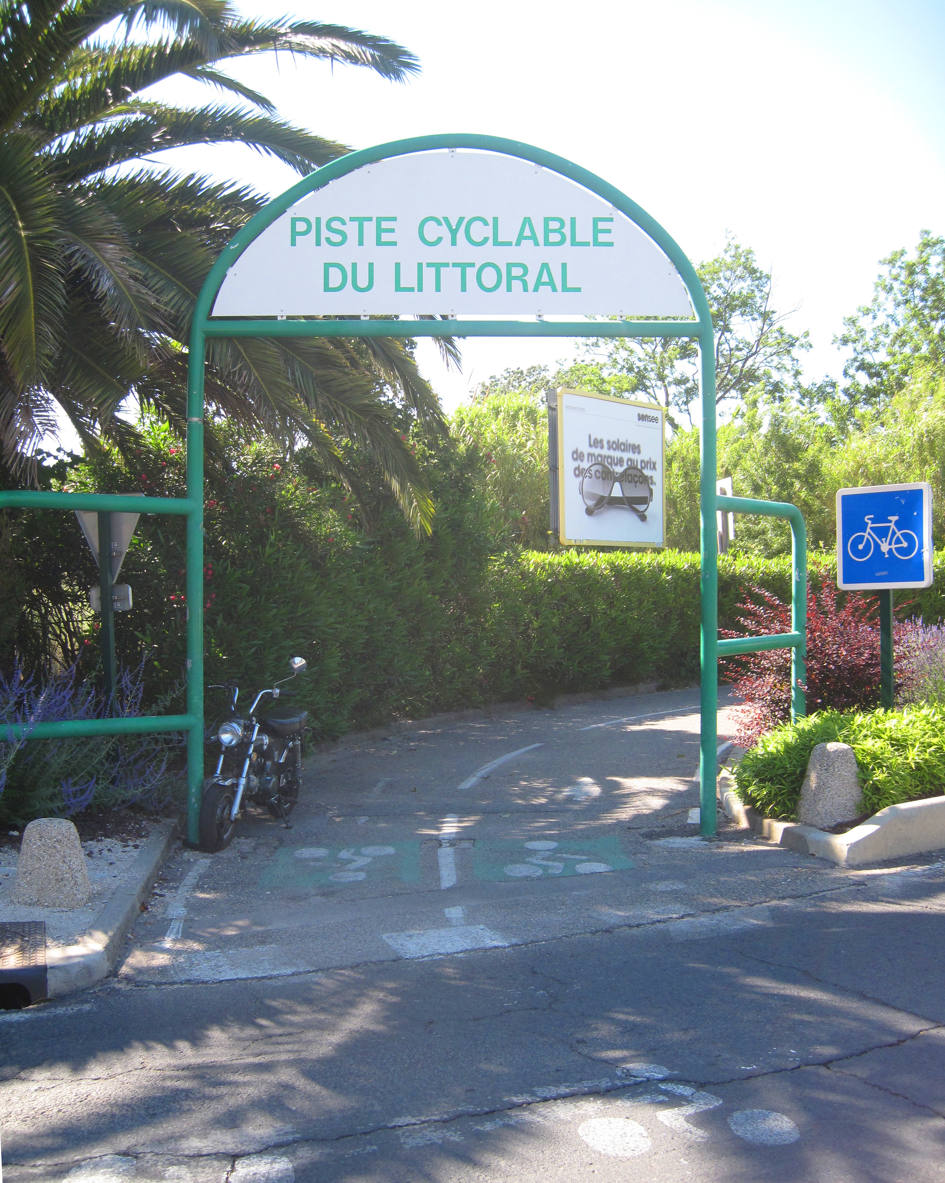
You will ride on road and bike path surfaces that are invariably smooth and pot-hole free, and flat— with some notable exceptions mentioned below. You''l find your way easily. Bbike routes, such as the Piste Cyclable du Littoral, are normally well marked. Where the signs are nonexistent or hard to follow, I give directions below.
Bike Path of the Littoral, between Toulon and Hyères

Don't cycle this route (in any season) if you want to stay far away from highways and traffic. Usually the only reasonable route lies on or nearby the costal highway. You will ride roughly one-half the distance from Marseille to Nice in bike lanes, bike paths, or minor roads. The rest requires riding in traffic on a highway. More bicycle paths are planned, and some of these away from the highway, but I saw no sign of their construction. French cyclists along the Riviera are accustomed to cycling on the highway. Throughout the length of this itinerary you will see, and occasionally meet at cafes, cyclists out for the day.
A double room in a nice hotel costs from €80 to €120 (2012) — fifty percent more in the center of Marseille, Cannes, and Antibes (or, if you have the budget, the sky is the limit!). Campsites cost €15 to €20 per night for one or two people (€5 more in July and August).
Arrival and departure: If you come to Marseille (Michelin ***) by plane, transfer to the Marseille train station by shuttle and regional train (about a 45 minute trip) or take the train directly to Marseille Saint-Charles. If you are bringing your bicycle on the train from Paris in a bike bag (housse) you can take a direct TGV and arrive at Marseille Saint-Charles in 3 hours. It is presently an all day journey in a seccession of local trains (TERS) to arrive in Marseille from Paris with an assembled bicycle. I have foundon line (2019) only one possible bike rental for the route, which is quite hilly: an electric trekking bike from a company called "evtt-provene.com. You would have to take a very crowded local train (TER) for 3-4 hours to get this bike back to Marseille. TERS on this line usually have a car with a place for one or two bikes, and should not be boarded during rush hours. With a bike in a bike bag, a TGV return directly from Paris is possible
It would also be possible to do this trip in reverse or to possibly arrive at the Nice airport, and cycle from there, or put ones bike from there on the train to Marseille, or possibly rent there. It appears that one or more rental companies may have possibly suitable touring bikes and/or electric touring bikes, including "Holiday Bikes". I have not personally checked out the bicycle rental companies mentioned in this paragraph nor the paragraph above.
As is the case elsewhere in Europe or America, it is not safe to leave a good-quality bicycle — even securely locked — for even an hour — on the streets of a large town or city. Therefore, if you are going to cycle the Côte d'Azur and you want to walk about freely and visit museums in big towns, you will need to overnight and leave your bike at your a hotel or other secure place.
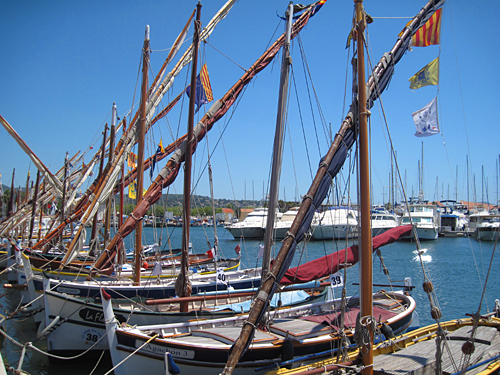
Traditional fishing boats in Bandol.
Will you enjoy cycling the French Riviera? Yes, if you don't mind traffic and if you skip over the parts that don't appeal to you. By cycling the Riviera and you will lose pounds. Go by car or train and you will put them on. By cycling you will go at a slower pace, meet more people, take in more of the Mediterranean and the countryside, and understand more of the geography of this fabled part of France.
The itinerary below is laid out from west to east. This permits you, on average, to have the wind at your back for most of the ride, though it on average will be against you during sections 7 and 8. In winter, spring and early summer starting from Marseille, if the fierce Mistral wind blows, you will surely be wanting to ride west to east. If you are riding only sections 6,7 and 8, however, you should strongly consider riding westward.
Detailed Itinerary for Cycling the French Riviera (Cote d'Azur)
Sections of the Bike Trip from Marseille to Nice and Menton — directions, and recommendations on whether to cycle or to take the train:
Note: Train connections are available at the beginning and end of each section.
Section 1: Cycling from Marseille to Cassis and then to either La Ciotat or Les Lecques.
Distance: 42 to 50 kilometers. Rating: Excellent as far as La Ciotat, then Good.
Recommendation: Cycle Section 1, unless you hate climbs. Stay one or two nights in each of Marseille and Cassis.
Section 2): Biking from Le Lecques to Toulon.
Distance: Approximately 29 kilometers. Rating: Medium to Poor.
Recommendation: Skip Section 2 and 3: Instead, go to Hyères by train and cycle in the area. If you wish to ride the entire length of the Rivera, ride Section 2 and Section 3 on the same day .
Section 3: Biking from Toulon to Hyères.
Distance: Approximately 20 kilometers. Rating: Generally, Medium. Biking near Hyères, Excellent.
Recommendation: See Section 2. Stay two nights in Hyères-Plage or on the Giens Peninsula.
Section 4: Biking from Hyères, via Le Lavandou, Saint Tropez and Sainte Maxime, to Saint Raphaël .
Distance: approximately 80 kilometers. Rating: Good.
Recommendation: Consider riding Section 4 if you want to visit costal resorts, such as Le Lavandou, Saint-Tropez and Sainte-Maxime. Stay one night in Saint-Tropez or Sainte-Maxime and combine the rest of Section 4 with Section 5.
Section 5: Biking from Saint Raphaël to Cannes via the Estérel.
Distance: 36 kilometers. Rating: Very Good.
Recommendation: Ride Section 5 to see the terra-cotta-colored Esterel Mountains. Stay one night in Cannes.
Section 6: Biking from Cannes to Antibes to Nice
Distance: 31 or 38 kilometers. Rating: Excellent.
Recommendation: Ride section 6. Walk your bicycle around Antibes. Stay two or more nights in Nice.
Section 7: Biking the Grande Corniche from Nice to Menton
Distance: 33 or 38 kilometers. Rating: Excellent but a stiff climb.
Recommendation: Ride Section 7. If you are up to the climb, the views are unforgetable. Rocquebrune and Menton are well worth a visit. Stay in Menton or return by train the same day to Nice.
Section 1 — Cycling from Marseille to Cassis and then to Le Ciotat or Les Lecques :
Distance: Approximately 40 to 52 kilometers. Rating: Excellent as far as La Ciotat, then Good.
Arrive in Marseille(***)/ Allow one or two nights in Marseille to see the sights. I recommend the old port (Vieux Port) and the old town (vieille ville), for two. There are said to be some good museums, and the possibility of a boat trip to the Calanques or to visit the working port. Marseille is the third largest metropolitan area of France and the largest Mediterranean port (third largest port of Europe).
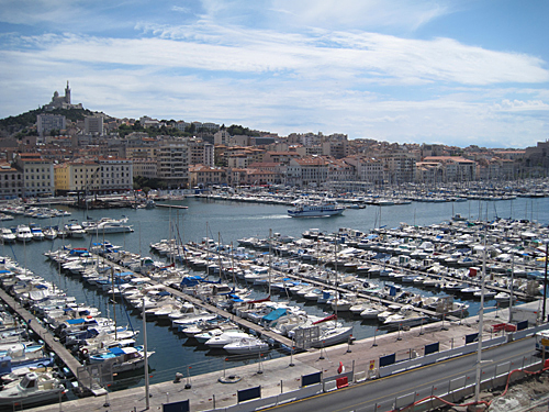
Le Vieux Port (Old Port) of Marseille.
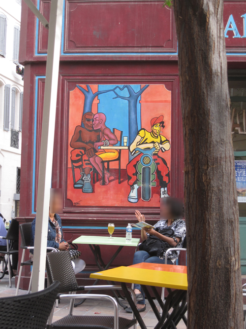
Marseille Old Town Cafe.
Marseille to Cassis:
You have a choice of routes for leaving Marseille: the Rue de Rome or the Corniche President Kennedy. If you leave Marseille by the direct route to Cassis, you ride in bike lanes along the Rue de Rome, which changes its name to Avenue du Prado and then at a traffic circle (where Ave. du Prado turns sharply right), to the Boulevard Michelet.
If you leave Marseille by the Corniche President Kennedy, which I recommend for its views of the Mediterranean and the Chateau d'If (where the Alexander Dumas' Count of Monte Cristo was imprisoned), you will ride an additional 7 kilometers in light to moderate traffic. From the Old Port follow the corniches south along the Mediterranean as far as the Avenue du Prado (sign Park Borély). Turn left, and turn right at the next intersection, which leads into the Park. Ride to the far end, exiting through the gate by the Chateau, or if it is closed, the gate up the stairs to the left of the chateau, behind the merry-go-round. Turn left and follow this road back alongside the park and continue until it ends. There, turn right and immediately left on Boulevard Barral. Turn right in one block onto the Boulevard Michelet (as in the first option) and continue following the signs for Cassis.
View back to Marseille and harbor from the Cassis highway.
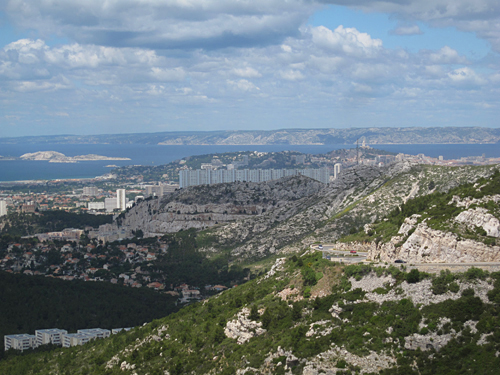
View towards Cassis. The cliffs behind Cassis (tomorrow's ride takes you atop them) are the highest in France.
For either option you soon veer left off Boulevard Michelet following signs for Cassis There are now four kilometers on this relatively wide road in moderate to heavy traffic. Then you leave Marseille and ride in very light traffic climb to a pass at about 300 meters (1,000 feet) and descend to Cassis. Be sure you have downloaded maps of Cassis and its region, as road signs are confusing. Ask for help, if need be. (Distance from Marseille: Approximately 20 or 27 kilometers.)
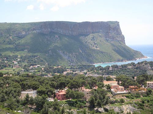
Cassis is a marvelously pretty little fishing and pleasure port, worth enjoying for a night or two. If you stay two nights, walk or take a boat trip to the Calanques, which are the limestone cliffs and coves along the sea to the west between Cassis and Marseille. The steep cliff that you see to the east is beneath where you will be riding when you leave Cassis.
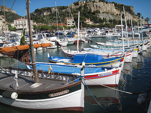
Cassis fishing boats.
A shop in Cassis.
Cassis to Les Lecques:
Heading East from Cassis, the Route de Crêtes makes for spectacular riding. The earlier in the morning you leave, the less traffic you will encounter: There is very little commercial traffic, and tourists normally don't start getting on the road until 9:30. You have several choices leaving Cassis that all join. Some are steeper than others—so steep that many riders won't be able to ride them. The least steep in the Rue de la Ciotat (D141). After the routes join, there is a hundred-meter-long stretch of road near the top that climbs at at 30 to 40 percent (really!). The total climb is about 300 meters (1,000 feet). Once up on the top, I strongly recommend that you stop at the big parking area near the cliff edge (Michelin ***), about 200 meters before where the road curves sharply to the left — just under 5 km out of Cassis. Lock your bicycle and walk out to the cliff edge at the back right corner of the parking area, then along the cliff to the left. The cliffs are the highest in France: 1,000 feet straight down to the sea. In the distance are Cassis and the calanques.
Stop again at the Sémaphore (***) on a side road towards the cliffs and walk out to the viewpoint.
On the Route des Crêtes.
You now descend to the center of La Ciotat, leaving D141. Follow signs to the right if you are interested in shipyards. Otherwise, turn left at the T for the train station. You can ride slowly alson a charming paved path near the beach (Grand Plage), or you can choose a faster bike route that is a couple of blocks inland. Just after the beach road, D40b, turns inland (north) you come to a traffic circle. (If, rather, you are on the bike route, you will arrive at this traffic circle from the east.) I recommend that most cyclists skip the ride between here and Hyeres. To ride to a train station you have a choice: To reach the La Ciotat train station go straight north for 1 kilometer on (now) D40a, and turn right on Ave. de la Gare.
Or, at the traffic circle turn east to continue riding along the coast towards Toulon or to the next train station. The street soon joins highway D559, and you ride in a bike lane but twice veer temporarily off to the right to visit beaches; then you bear right onto Avenue du Port (D66 ) and ride into pictoresque Les Lecques. For the railroad station, at a small traffic circle take the left exit, still on D66, cross D559 at a big traffic circle and continue straight on the Av. des Lecques to the railroad station of Saint Cyr-Les Lecques. All trains from both La Ciotat and Saint Cyr-Les Lecques run to both Marseille and Toulon. Here is a link to the timetable. Trains run every hour at mid-day and every half-hour during rush hours.
Since I recommend a visit to the Giens Peninsula, near the Hyerès train station, change trains in Toulon (if necessary). For Directions from the Hyerès train station, see the italicized text towards the end of Section 3.
Section 2 — Biking from Les Lecques to Toulon
Distance: Approximately 29 kilometers. Rating: Medium to Poor.
With the exception of Bandol, this part of the route goes through suburban and urban sprawl, and has little to recommend it either scenically or as pleasant cycling. There is some pretty shoreline, but it is substantially out of the way. There are places where you must ride on busy highways, some of them narrow, so you will have to be comfortable riding blockking traffic. Thus, unless you are determined to cycle the entire Côte d'Azur, I recommend you skip bicycling this section of the Riviera, and the next section as well, and take the train from La Ciotat or Les Lecques to Hyères.
To cycle this section, I suggest that you stay on the sea-side road, Bvd. de la Plage, as long as possible, to a traffic circle where Av. de Tauroentum (D87) branches off to the left. Follow this as long as possible to a T; turn right, cross under the tracks and turn right again immediately onto D559. (If you are coming from the Les Lecques train station, head eastward on Av. de la Gare, turn left on D66 at the T, take the second right onto Bv. Jean Jaurès (D67) which after 600 meters becomes D559).
This is a narrow portion of D559, initially confined with walls on both sides, and full of traffic which you will block. The highway climbs to a pass at about 500 feet, after which the road is wider. After about 6 km, veer off at the first exit sign for Bandol. Ride continuously downhill, turning let when required and then right. Once at the costal road, follow it eastward. The total distance to the center of Bandol is about 9 kilometers. As is usual along the Mediterranean, Bandol is quite charming. The railroad station is north (uphill) from the center of town.
Soon, you again find yourself on D559, which you follow by the harbor of Santary-sur-Mer, in medium traffic. The road is sufficiently wide to provide a margin of safety. This is your last glimpse of the Mediterranean for two or three hours. Now you ride through a residential area a few blocks back from the sea. The sidewalk only looks bikeable, as it starts and ends abruptly, and narrows unpredictably. As you enter Six-Fours-les-Plages, after passing the major intersection with D63, you could turn off the main route onto a bicycle path along the D616 that would take you along the shore; but with all the coast that you have seen and will see from Hyères on, I don't recommend making the out and back detour. Rather, bear left at the traffic circle shortly after D63 into the cycle lane of D559, Avenue de la Mer.
For the next eight kilometers you are going to ride alternatively in a bike lane of D559 or on a bike path right along side it. You are well away from the sea in a French version of urban sprawl. The bike route is signposted, but the signs are confusing and require you to cross D559 more than once onto parallel roads. After a couple of kilometers, there is a bicycle path next to the road on the north side. Rapid progress is interrupted by stoplights and traffic circles.
The simple rule for directions here is to stay on or by D599 all the way to Toulon.
However, it is possible to become lost, and as there is no cycle route in Toulon itself, here are the detailed instructions:
D559 bears to the left at a traffic circle (roundabout) and again at a subsequent one, heading northeast (Avenue Maréchal Juin, later Ave. des Anciens Combattants d'Indochine). At the 5th (large) traffic circle after that one you stay along D559 (and Ave. des Anciens Combattants d'Indochine) where this goes off to the right (eastward). Note that the bicycle path, which was on the left of the road, crosses before the traffic circle and now is on the right.
You cross a busy intersection in 1 kilometer, and continue in the same general direction (name change to Blvd. Maréchal Alphonse Juin). The bicycle path ends at a complicated intersection where D559 bends to the north. You must briefly ride in traffic through this intersection and then intermittently in the right lane of this divided highway (dual carriageway). After several bends you approach a large traffic circle where a sign indicates Toulon and the Autoroute to the right. On the right is a lane by a factory building, which you should take. Turn right in front of the building (still beside D559) and a pleasant bike path (not along the highway) starts up. See this map of Toulon.
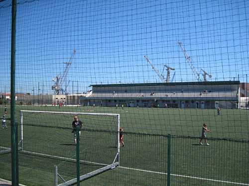
Sports field near Toulon.
When the bike path ends near the Palais des Sports, you are in the center of town. Cross under the highway on the street that angles north east from the traffic circle (Av. Laurent Matto). At the T, walk your bike to the left for one block and turn right uphill. Take the first right, and in three blocks angle left on Av. de Dardanelles. In just over two blocks you reach the corner of the railroad station. The street in front of the station is one way against you, so walk your bicycle to the station entrance. Because of the complicated layout of expressways in Toulon, I suggest that you might want to follow the route to the railroad station, even if you are continuing on from Toulon on bicycle. If, however, Toulon has extended the bike path to permit direct access to the Bv. de Strasbourg, by all means use it. It will save an unnecessary climb and descent.
Section 3 — Biking from Toulon to Hyères.
Distance: Approximately 20 kilometers. Rating: Generally, Medium. Biking near Hyères, Excellent.
After Toulon, for 160 kilometers, the French Riviera is lined with one beach resort after another — all the way to Nice. Hyères is the first train stop near the coast after Toulon, and a fine area to cycle in. Especially if you are taking the train into Toulon, why not continue on a train to Hyères, skipping the ride from Toulon to Hyères? The ride from Toulon to Hyères is not a scenic high point. From the Hyères train station is is only a 4 kilometer ride south on D559 or D197 to the beginning of the peninsula. Traffic is normally light, and a bike path is available. I give this part of the route a medium rating because a) one must cycle in bus lanes in Toulon, and b) views are not outstanding.
From the Toulon railroad station, unfortunately you have to bike on the main downtown thoroughfares for 1.5 km to get to a bicycle path. From the train station, bike downhill steeply on the road in front of the station, perpendicular to the tracks. At the light, Blvd. de Strasbourg, turn left. Ride in the bus lane for 0.9 kilometers. As this street becomes one-way, you must bear right onto Rue Dr Luy Puy. A bicycle lane begins. You follow this to the left at Ave. Roger-Devoucoux. It appears from maps that this will eventually lead into the bicycle path, but as of this writing you must continue in the same direction for a short distance in the the street, making a slight move to the left onto Ave. Alphonse Juin. (Do not go left at the Y onto D97 —Ave. François Cuzin). At the next roundabout the bike path begins. It initially runs along the Autoroute (which has emerged from a tunnel), but soon curves right into a park.
Once you get out of central Toulon, it is pleasant cycling on a bicycle path on the bed of an old rail line, through the woods for 5 km, and then pretty nice for another 11 km on a bike path along a road and eventually bike lanes, with medium traffic (D559 again) in the suburbs (La Garde, Le Pradet) and then farmland (to Carquerianne) . The authorities in the Var Department are proud of their bike route, and they often mark sections of it with large signed gates.
Start of a segment of the Littoral Cycle Path.
The bike lanes or paths continue to the roundabout where the Giens Peninsula. begins. Depending on where you will be staying, you can turn south on the Route du Sel, or you can continue east across the peninsula on the Route des Marais, D42) in very light traffic.
To ride to the Giens Peninsula from the train station, follow these directions: In Hyerès, from the train station, cycle to the right on Rue de la Gare; bear right at the little traffic circle. At the big traffic circle with palm trees in it, go straight (to the left of the round metalic building. Take the first right, and follow this road around to the right 90 degrees until it dead ends. Turn left, and imediately jog left and right onto the Traverse des Nartettes. This narrow road almost without traffic turns left (south), running between the rail line and fields. At the T, turn right into the Chemin du Palyvestre (wide bike lane), and in 200 meters t the light turn left on D197 (bike path).
At the big roundpoint you have arrived at the Giens peninsula. have a choice of riding to the "Port" area where there are several hotels and restaurants, or continuing straight towards Giens. Presumably you will have read about the area and know where you are going.
The east side of the Giens double peninsula, where hotels and villas are located, has a long ribbon of brown sand beaches, whereas the west side has a narrow ribbon of white sand beaches, and it is often described in promotional materials as a cyclist's paradise. Between the two spits of land (tomolos) lie salt marshes, often with flamingos, especially in September. At the south end of the peninsula, four kilometers from the mainland, lies the town of Giens, with a rocky shoreline that has some coves with fishing boats and small pleasure craft moored in them, but no natural harbors.
Giens Penninsula — beach along Route du Sel.

Michelin gives the Giens Peninsula. two stars, and the nearby Ile of Porquerolles and Ile of Port-Cros (Isles de Hyères), reached by ferry, three stars. The main activities on these islands seem to be beach-going, walking, and mountain-bike riding. Only strong bicycles with wide tires are suitable, according to one bike shop I phoned there. Stay in the Hyères area a night or two or more.
The Hyères Islands form the southernmost point of the French Riviera— or for that matter, the southernmost Mediterranean point between Beziers (on the way to Spain) and Plombino (southwest of Sienna, Italy). From Marseille to Hyères you will have ridden east and and a bit south. From Hyères to the Italian border, you will ride almost as much north as east.
To ride to the Hyerès train station, reverse the directions in the italicized text above.
Continue to Page 2: Sections 4, 5, 6 and 7 of Cycling the French Riviera.
To List of Best European Bike Tours