
by David A. May
Last cycled May, 2016, from St. Nazaire to Chalons-sur-Saône
Last cycled June 2017 Dijon to Ülm
Last cycled June 2019 Ülm to Vienna
© 2015-2023
by David A. May
Difficulty: Easy to Moderate –two days are hard in steeper terrain
Bike Rating: Mainly Excellent
When to Ride: Ride during the months of June, July and August to experience average daytime maximumtemperatures above 68º F (20ºC) and average nighttime minimum temperatures above 50ºF (10º C). During these months there are about ten days per months with rain in an average year, about three or four inches of rain total each month. Check with hotels and b&bs to see if reservations are necessary, or if they can be shifted in the event of heavy rain. Many of the most popular hotels book up months ahead. The Basel area costs many times as much during ArtBasel in mid-June. Certain other towns have festivals, or even large weddings, when it is very difficult to find a last minute room. Should you not wish to pedal, trains serve almost all of the route and along the Danube after Regensburg in Germany and in Austria and Hungary there are passanger-carrying ships.
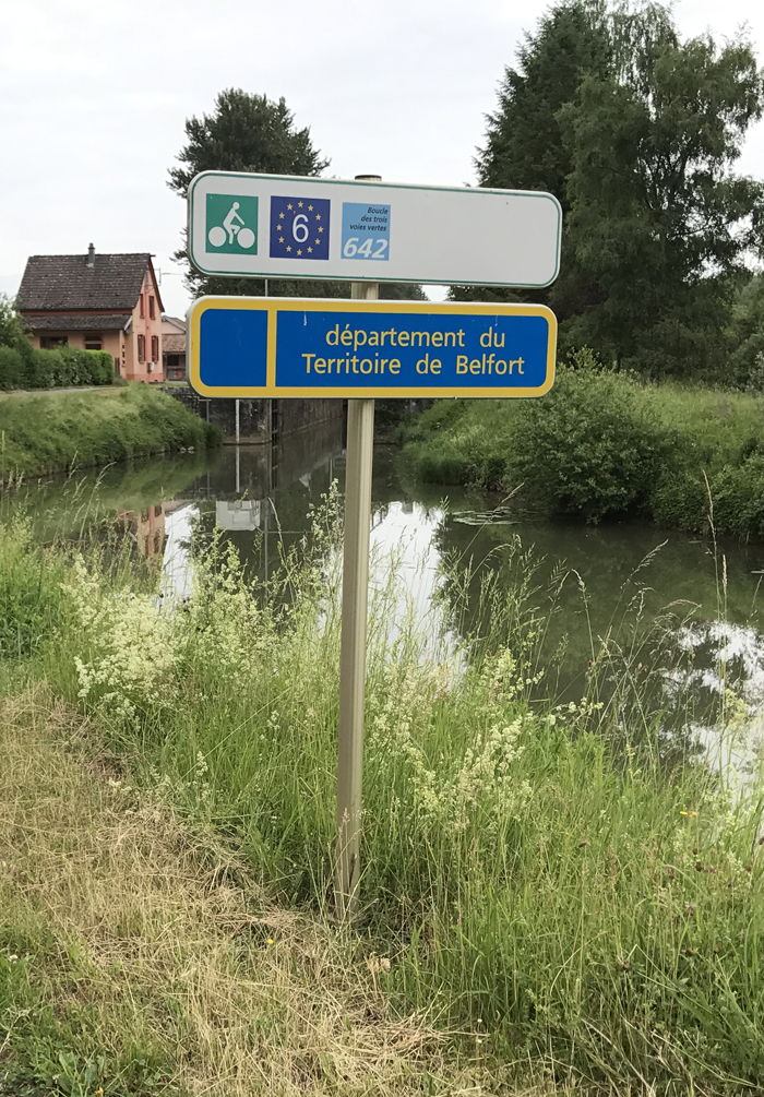
France (white with green bicycle):
Switzerland (Burgundy color):
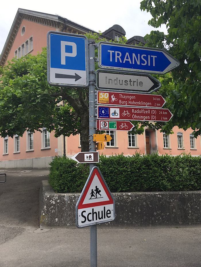
Germany (white with green lettering) (yellow signs are for walkers):
.jpg)
Guidebooks: There are signs all along Eurovélo 6 indicating the way, but my experience is that one can occasionally get lost, and moreover, it is comforting to know where one is headed. The town maps in the guidebooks are useful. If you have been riding from the Atlantic Ocean, you may already have the Eurovelo 6 book published by Chamina. It is available for €12 at amazon.fr, or could be purchased at Au Vieux Campeur in Parsi, or for much more in the USA or Britain.The maps therein were comforting and particularly helpful in Basel (Bâle in French) and where we deviated from signed route to visit city centers or to reach hotels. By disassembling the book, I could easily fit a series of pages into the plastic viewarea of my handlebar bag. This book's map from Dijon to the link-up with the main Eurovèlo 6 route, however, was insufficient, and we had to ask for help several times to find our way on the vineyard lanes and through Nuits-st-Georges. I provide a map below. There are also map packs available that I have not had a chance to review.
Along the Rhine and sometimes along the Danube there are choices to be made as to which bank to cycle on. Guidebooks can help you make an informed choice. The books can be un-bound and the individual pages placed on a handlebar carrier.. For the Rhine there is Teil 1 (Part 1) of the Esterbauer book Rhein Radweg (Rhine Bikeroute €13.90 on Amazon.de - 2017 price). It is in German, and covers the Rhine from its headwaters to Basel. Maps (maps 17 -26 are useful for a Eurovèlo 6 trip). For the Danube Bike Route through Germany see the first of four Daube guidebooks in English by that name published by Esterbauer. For the Danube Bike Route in Austria, from Passau to Vienna, see the second of the Esterbauer books. There are a total of five volumes covering the entire route. These are price €13 to €15 each from Amazon.de, £15 to £17 from Amazon.co.uk, and $19 to $21each from Amazon.com. Maps of the route are available for sale, but I have not reviewed them. It is also possible to make screen copies of bikemap.net maps. Below I have shown some for key trouble spots, but getting the necessary detail and format for an entire trip, in my opinion, is not worth the effort, and the pages will not be waterproof.
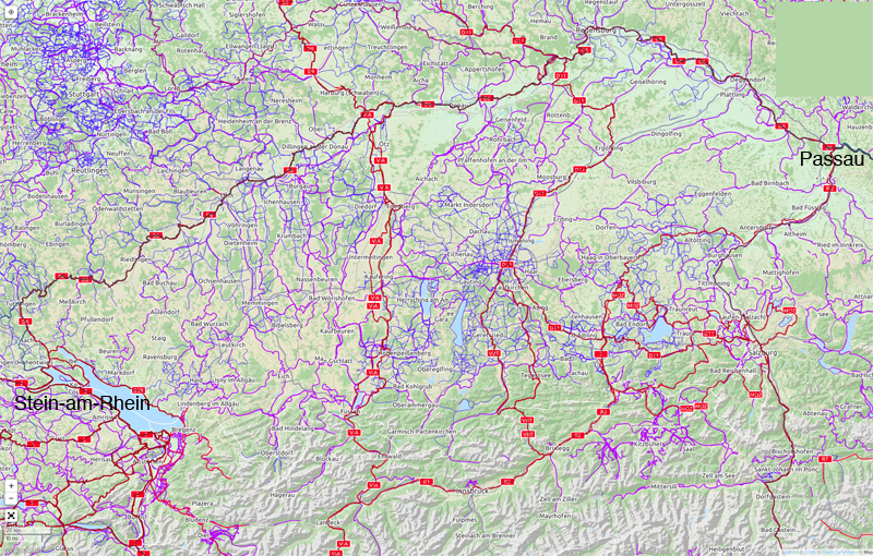
Germany is cris-crossed with signposted bike routes so it is possible to reach Passau without following the Danube. Many of these have guide-books from Esterbauer (in German)and all the relevant bikeroutes are shown clearly on opencyclemap.org at a medium magnification and on the site of the Bavarian government: http://www.bayerninfo.de/en/bike. Depending upon the routes chosen, the total vertical elevation will not greatly exceed those of the Danube route, (considering the big climb to the Danube from the Rhine). If one choses to pass through Munich*** on bike routes (or using suburban train connections), the total distance cycled will be about 100 km less than than the Danube Route. One possible route would be to go from Stein-am-Rhein to Konstanz to Lindau** on the Bodensee and then by the Bodensee-Königsee Bike Route that skirts the Alps to mad king Ludwig's castle*** near Füssen, and then by Romantic Road branching onto the Ammer-Amper Bikeway and then via the Ammersee Biker Rute to Munich. From Munich there is the Issar river Bikepath to Ismaning, then the Sempt-Issen Bike Routeout and the Issental Way to the Inn River bike route to Passau. Many other choices are possible.
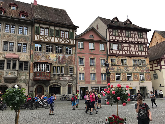
Attractions on the Rhine (my ratings) are Basel**, Bad Säckingen*, Waldhut*, the falls of the Rhine (the largest falls by volume in Europe)** and Stein-am Rhein**. On the 520 kilometer long German Danube the three main tourist attractions are the cities of Ülm**, Regensburg**, and, on the Austrian border, Passau**. The scenery in the upper Danube valley is superb. The castle in Sigmaringen, the Abbey in Obermarchtal, and the Blautopf* in Blaubeuren are also well worth visiting. I have no personal experience with sights in Germany beyond Ulm, except for Passau.** The The Austrian Danube has many interesting sights, including, of course, Vienna***; see my page on the Danube River Route in Austria.
Commentary and helpful maps:
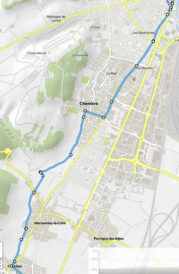
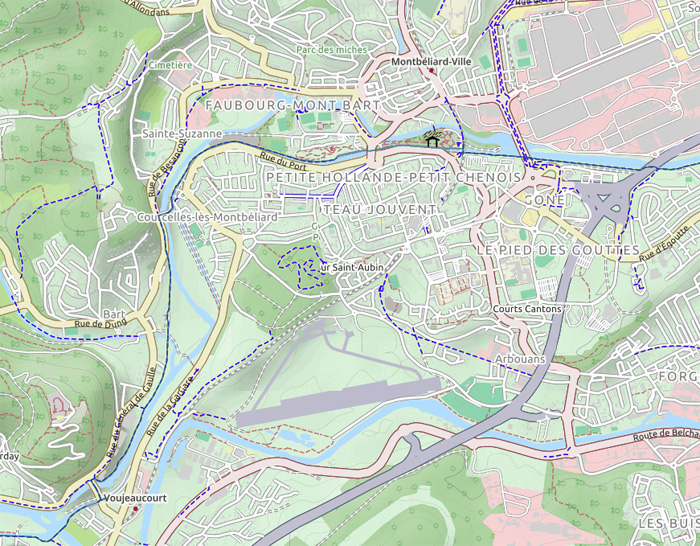
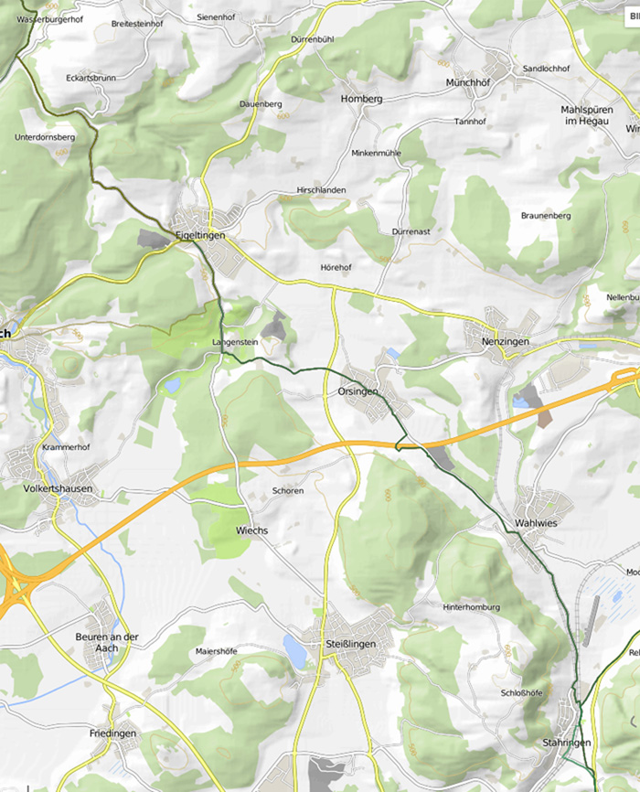
In 2017, I and my companion cycled from Dijon, Burgundy, France to Ülm, Germany. The alternative Eurovélo 6 route, starting from Dijon was more easily accessible for us that the main route coming from Chalon-sur-Saone. The ride through the vineyards and the possibility of a great meal and great wine in a Burgundy wine town make this alternative route well worth considering. The way from the Dijon rail station is poorly marked, and their is no signposting for the bike route through the vineyards. The way through Nuits-st-George is also not marked, nor the continuation along D114.. The maps below may help.
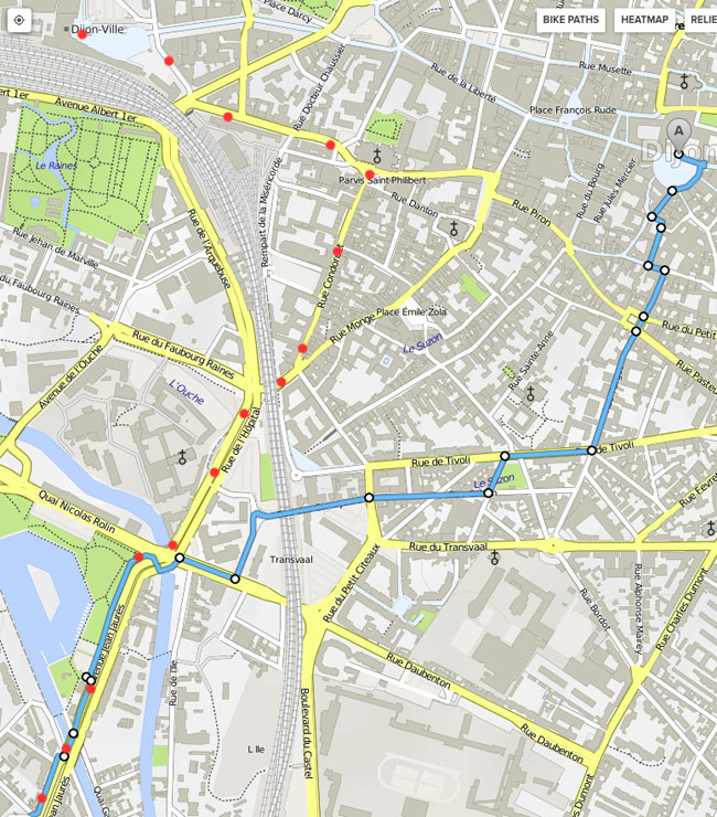

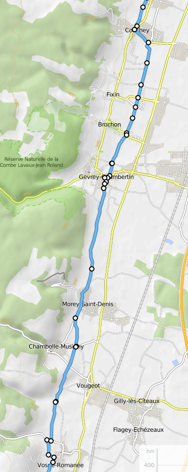

From this point the Guidebook maps are clear. However, there is no waymarking so if you are riding without a guidebook, the following map may be helpful.
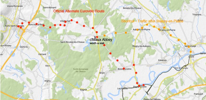
It is a huge short-cut, on to ride from The Abbaye de Ciseaux on highway D3 directly to Brazey-en-Plaine and then to St.-Jean-de-Losne. However this later road is filled with traffic - including big trucks – but it is sufficiently wide to be safe. The Eurovèlo 6, which does not use high-traffic roads unless absolutely necessary, follows a route that is 10 km longer.
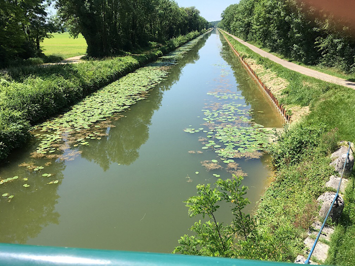
Along the Saône River and the Doubs (pronounced "Doue") Rivers the way is almost entirely flat, though there are a couple of steep climbs and descents where the canal passes through a tunnel or their is a shortcut off the canal. The total elevation gain over some 200 kilometers is only 500 meters, and this gain is almost entirely lost as the canal from the Rhine to the Rhone descends rapidly in Alsace.
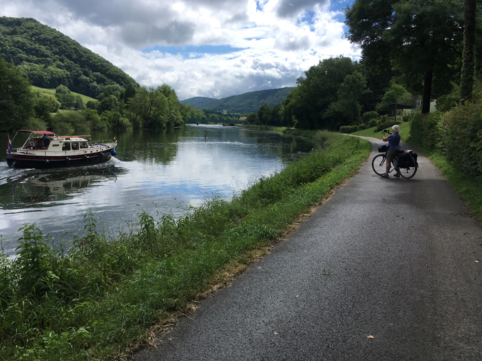
It is very difficult to lose one's way, unless one has selected a hotel that is far off the bike path or is visiting a central city. Besançon is one such confusing place. The old city and forts are hundreds of feet up a very high hill that the Doubs River loops around. The canal, and the main bike path, pass through a tunnel. Both the old town and the new town are worth visits.

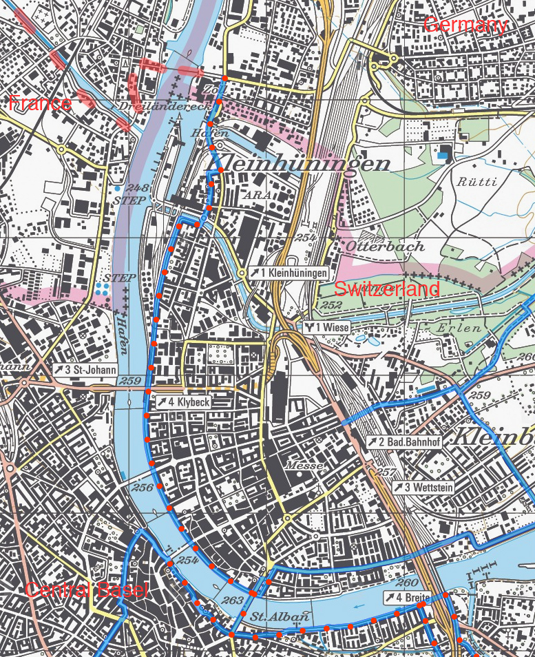
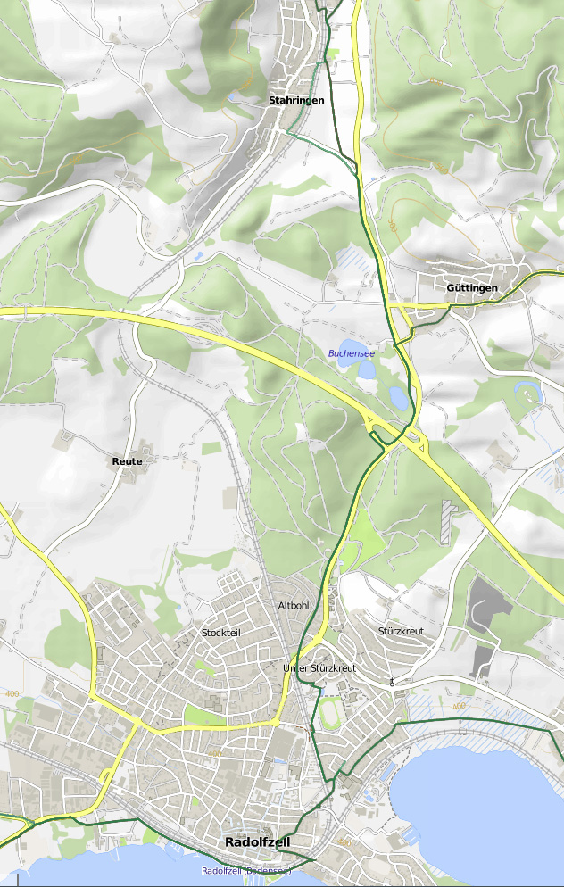
The next problem spot is when arriving from France into Switzerland and Central Basel (my red dots on the map below mark the main bikeroute): At the end of the Hunnige Canal bike path (not paved and a mess in heavy rain) coming from the upper left in France, it is very easy to get lost. There is a sign saying to make a u-turn but no sign evident as to where to go afterwardst: You must cross the little bridge and continue north several blocks to the Three-countries pedestrian bridge. (The way on the road to the right is possible on weekends; but on weekdays you arrived at a locked gate.)
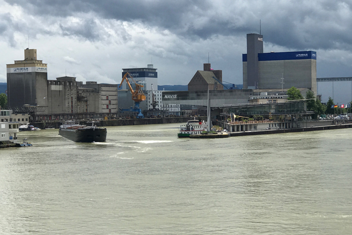
After you have visited Basel, along the Rhine the decision must be taken multiplle times as to which side of the Rhine to ride on. There are bike routes on both sides.. The north side is shorter, the south side (which is the Swiss National Route 2) goes by some Roman ruins. I have no opinion about this choice, as we took the train to Waldshut. In either case, the first 30 km out of Basel is in industrial landscapes.
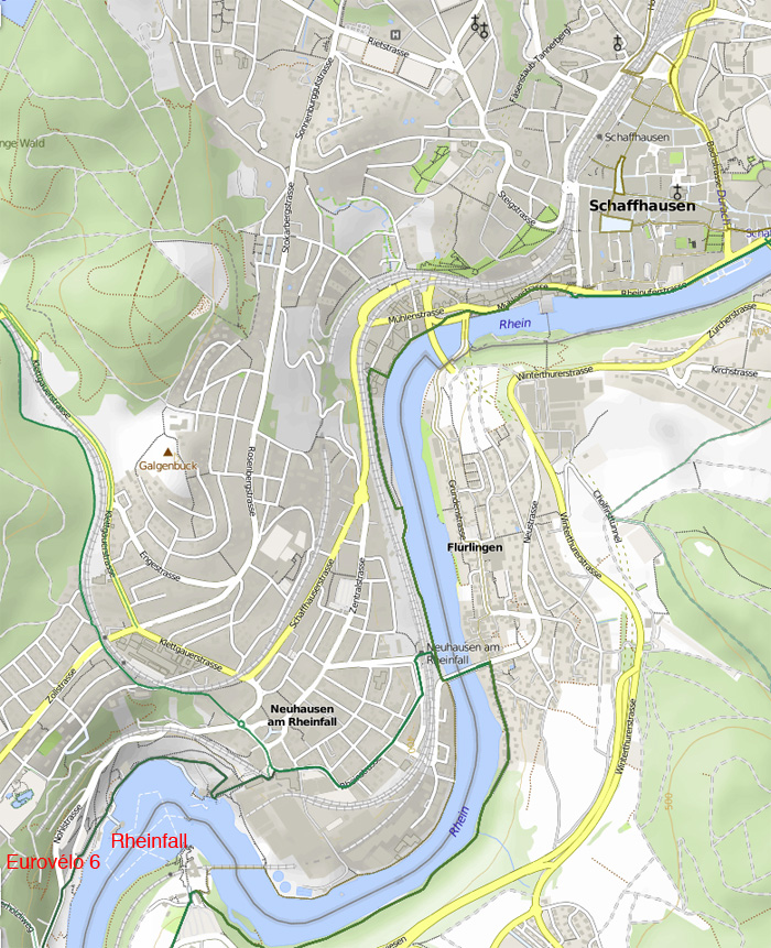
From Waldshut, Germany and Koblenz, Switzerland, I advise the south side of the Rhine, as it is shorter and easier. At Kaiserstohl – Hohentengen, I highly recommend crossing to the north side of the Rhine. The bike route to the Rhinefalls and Schaffhausen is much shorter and easier.
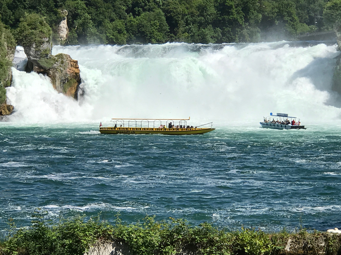
Be sure and ride down to the viewpoint for the Rhinefalls (a small version of Niagra Falls). Afterwards, it is a steep climb up from the falls. There is a bike-pedestrian path part way up that runs to Schaffhausen, saving some of the climb.
.jpg)
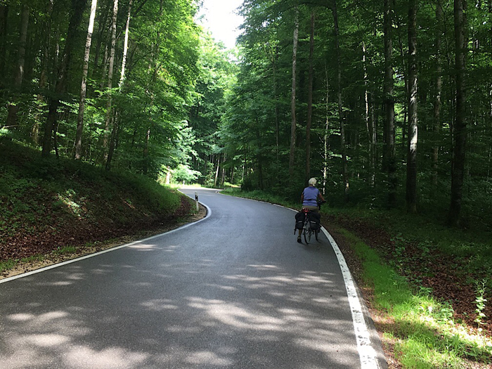
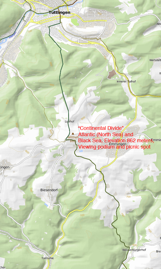
This day has the largest, longest climb of any on the Eurovelo 6 from the Atlantic Ocean to Vienna. We occasionnally walked our bicyles.
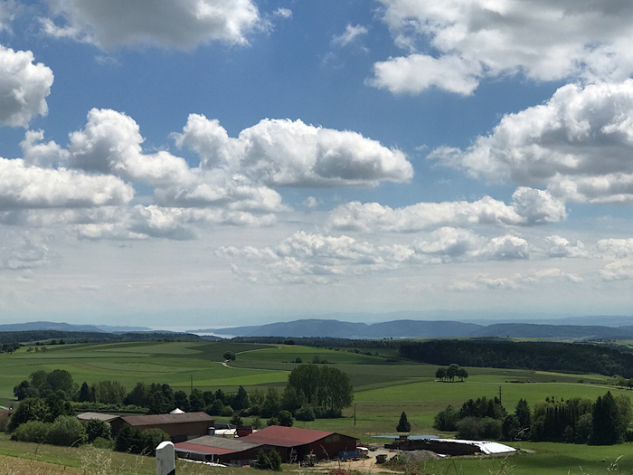
Be sure to stop at the view ring at the "continental divide" between the Atlantic and the Back Sea, for a wonderful view back to Lake Constance.
The guidebooks and the signage for Eurovèlo 6 along the Danube, as far as Ulm, is very good. We only lost our way on the Blautal detour, but the first mistake, when we missed a sign, quickly became obvious and the second one used a bikepath to Ülm that was faster than the official route, though it followed a major road. There is no need for maps.
Ülm Rathaus (city hall), the end of our rideon the Eurovèlo 6 this year:
.jpg)
Ülm is a very charming city, and it is worth spending two nights there. We returned to Ülm two years later to continue our ride on Eurovélo 6 to Passau, Germany, and on to Vienna, Austria.