
Last bike trip July 2011
Cycle "C2C" — Sea to Sea — Northern England: Whitehaven on the Irish Sea, Lake District, Pennine Mountains, Newcastle, and the North Sea
Bike on bike paths and quiet roads along National Cycle Network Route signposted C2C
Bike Rating: Very
Good
Difficulty: Easy to Hard
The C2C Bicycle Route: England has thousands of miles of signposted bicycle routes, almost entirely on bicycle paths and minor roads. The most difficult, it is said, is the C2C — the Sea to Sea Bicycle Route. However, any somewhat-fit cyclist, willing to push their bicycle up a handful of steep hills for a mile or two, can ride it. The Pennines are not the Alps.
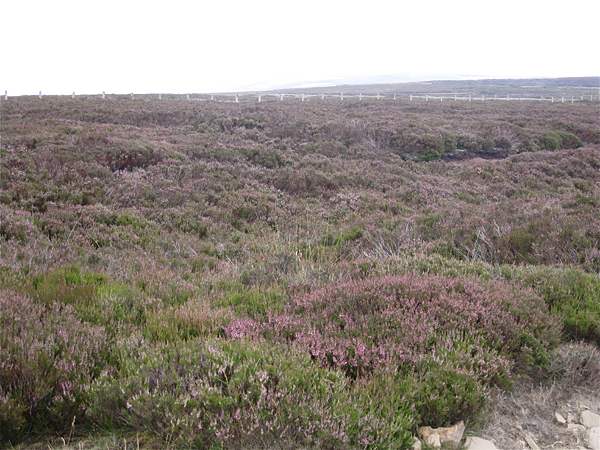
Heather after Rookhope along the C2Cin the Pennines— an exquisitely beautiful area.
I completely enjoyed my three days on the C2C. They were full of variety, and often very beautiful. As its name implies, you ride from the Irish Sea on the west coast of England (about 40 miles south of the border with Scotland) — where before starting traditionally you dip your bicycle wheels, for 135 miles (220 kilometers) to the North Sea on the East Coast —where you may again dip you wheels.
Because there are a handful of steep climbs, and because there are many sights to see and photos to take, only dedicated athletes will visit both Seas in one day. A two day trip is possible for strong riders, but a three-day trip allows you to have leisurely lunches and to explore each evening's stopping town on foot. If you are an easy-going or early-season rider, you may prefer a four or five day trip.
The C2C has three possible starting points within 20 miles of each other on the Irish Sea: Whitehaven, Workington and St. Bees, all in the County of Cumbria, and two possible ending points 10 miles apart on the North Sea: Tynesmouth, and Sunderland, both in the county of Tyne and Wear. I rode from Whitehaven, the most traditional and interesting starting point, with the additional advantage that the route from there visits much of the Northern Lake District; and I ended at Tynesmouth, because of Newcastle and Gateshead's extremely interesting architecture and river infrastructure. The other ending, Sunderland, is a seaside resort town.
Traffic is a concern only for very short distances in towns, as the C2Croute always follows bicycle paths and minor roads. It is very hard to get lost: The signposting, with one exception, was obvious and clear. As a backup, and to plan, every rider should have the excellent Sustrans C2C map. A guidebook is available, with summary maps, some history and tourist information, and listings of accommodations and restaurants. It appears that accommodations must pay to be included, but none the less very many are, and the guidebook is convenient for planning a trip.
Services are available to assist you, should you wish, including luggage services, transfers by car from the end of the C2C back to the beginning, hybrid bicycle rentals, and guided tours.
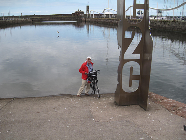
Dipping one's wheels in the Irish Sea (the evening before starting).
Nature of the Ride:
I divide the C2C route that I rode into seven sections, and after the text describing the section I include a few photos.
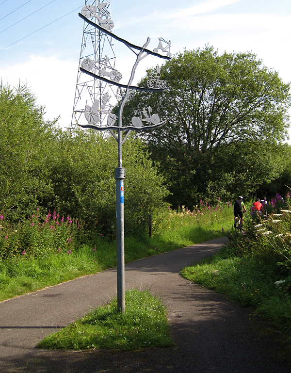
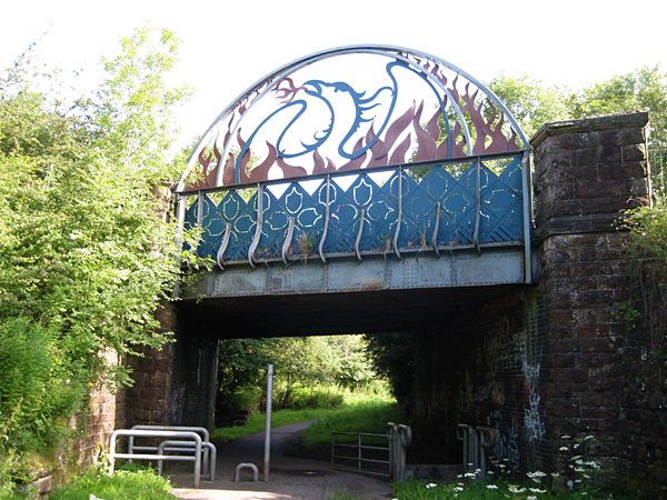
The first section, 10 miles in length, is on an old railway line from Whitehaven. It has no long views, but instead is adorned with sculptures. The path ascends slowly through the countryside and by villages.
Sculpture along C2C bike path near Whitehaven:
Sculptured Bridge over bike path near Whitehaven:
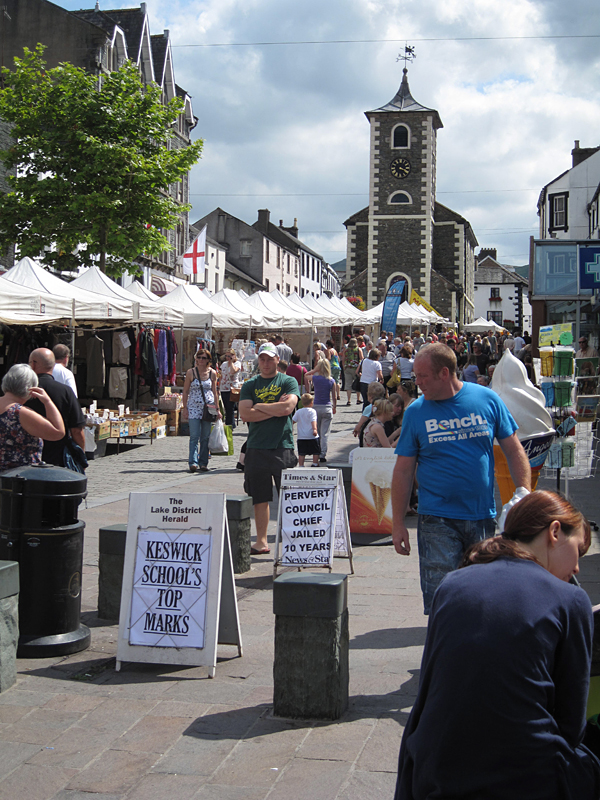
Next comes 20 mile ride through England's famed Lake District National Park, with long views of high hills and lakes. The terrain is mainly rolling, but there's one climb to Whinlatter Pass at 1,000 feet. At mile 30 you arrive in Keswick, the major tourist center of the northern Lake District, full of shops, pubs and restaurants.
View towards Ennerdale Water, Lake District:
View north from near Kirkland:
Keswick:
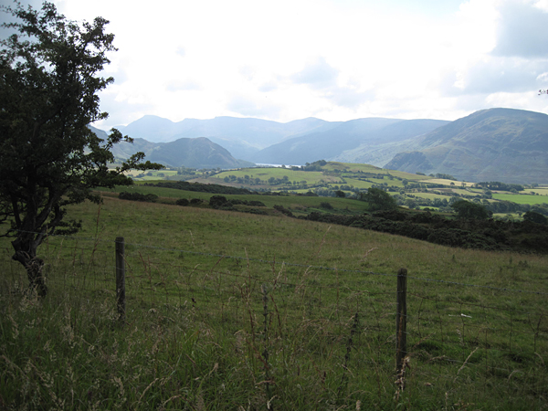
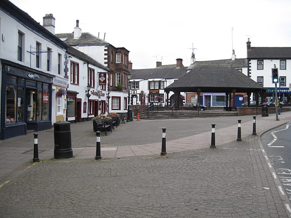
The third section of the ride takes you from Keswick to Renwick, from mile 30 to mile 65, in rolling terrain with lovely long views of the Pennine Mountains. At mile 53 you enter Penrith — the major market town of this region, with all kinds of stores and services.
View towards Pen nines:
Penrith:
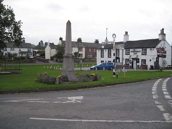
Langwathby:
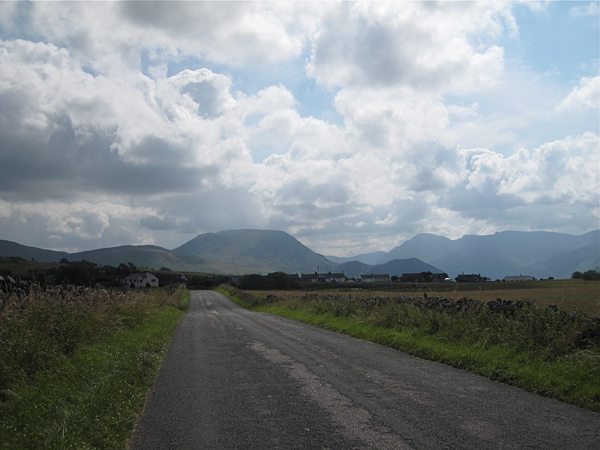
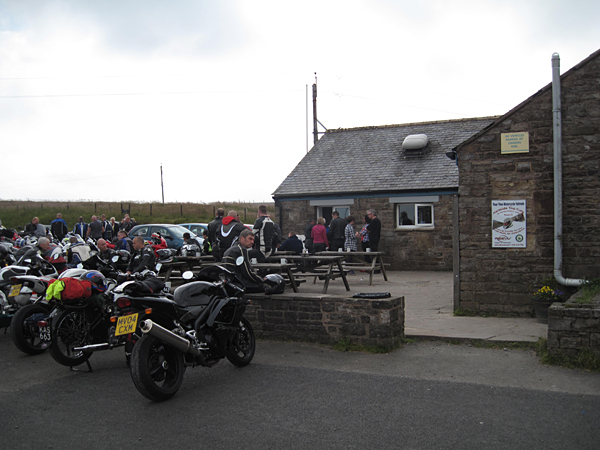
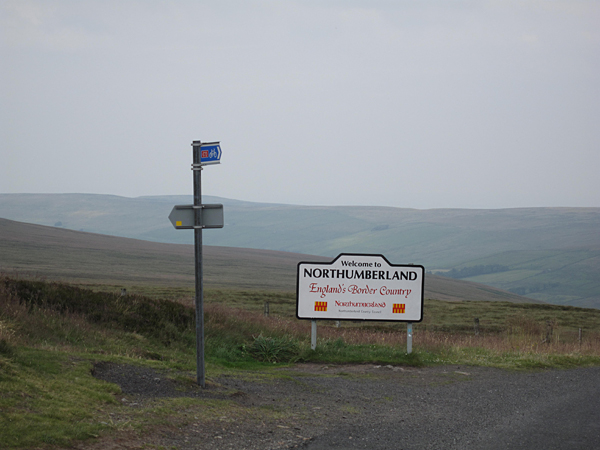
Next, a 1500 foot climb over five miles into the Pennines from Renwick leads to tiny Hartside (with its iconic café). This is followed by ten miles of exceptionally beautiful and steep descents and climbs, one of which visits the highest point on the British National Cycle Network, Black Hill, about 2,000 feet above sea level. You enter Northumberland. After more climbs and descents, you enter County Durham, and come to Allenheads and Rookhope at mile 95. This fourth section of the C2C is only 30 miles long, but it tests your lungs.
Hartside Cafe:
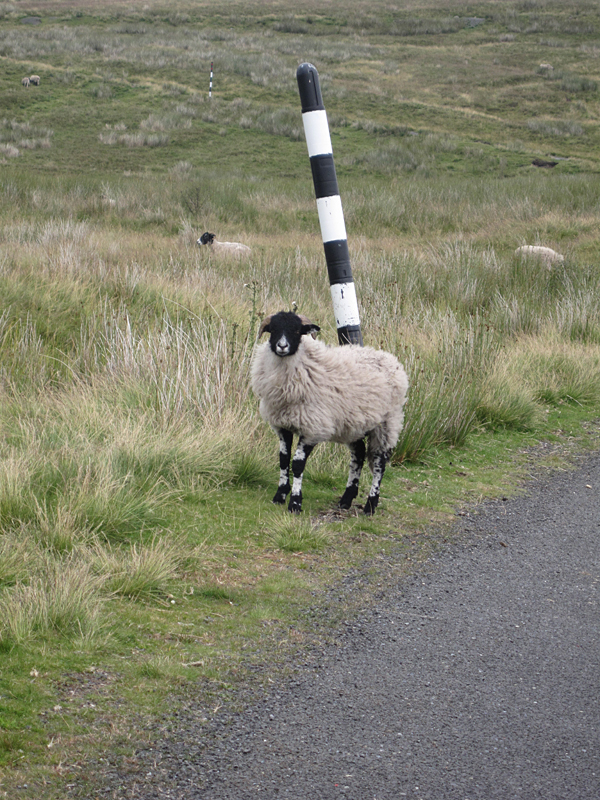
Entering Northumberland at the highest point on Britain's national cycling network:
A Northumberland sheep near the C2C high point:
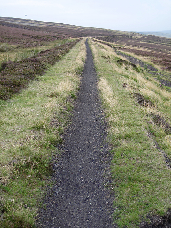
I give the short ride from Rookhope to Parkhead, only about 7 miles, a separate section because of its splendor. Perhaps these are the most beautiful seven miles I have ever ridden. The land belongs to a private shooting club, and will likely be closed in hunting season, in which case notice is posted and an alternate route through the valley is available. The initial climb is on a very rough and eroded track at perhaps a 15% grade; then you are on an unpaved track (rideable by a hybrid bike with 700-26 tires) and finally, on a narrow trail following an ex-railway bed. The final section of the trail becaume too narrow for safe riding. It could have been walked, or avoided by a slight detour onto a nearby paved road.
Looking back towards Rookhope after the steep climb:
Moors above Rookhope:
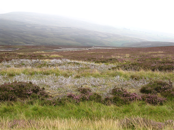
Trail along old railway line through moors above Rookhope.
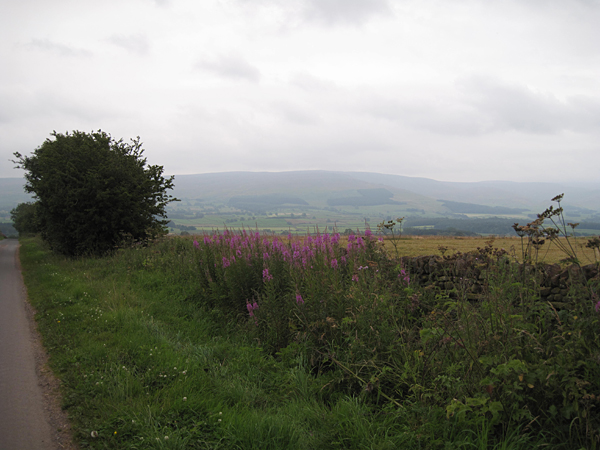
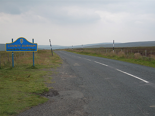
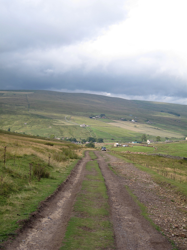
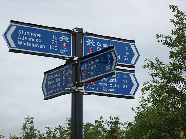
The sixth section of the C2C, from mile 99 at Parkhead to Rowlands Gill at mile 117, mainly follows old railway beds an constant descending grades, sometimes of compacted gravel, sometimes of grass, sometimes paved. It is easy and very pleasant riding with long views ahead, through rural countryside. Near Consett, the C2C divides: one way goes to Sunderland, and there are two choices to Tynesmouth. as you can see in the confusing sign n the second photo below. Take Route #14 for Tynesmout, unless you wish to do some supermarket shopping. If so, continue straight on Route #7 for one mile, and then follow the signs for the C2C to the left. This alternative winds through the outskirts of Consett, and you must watch carefully for signs.
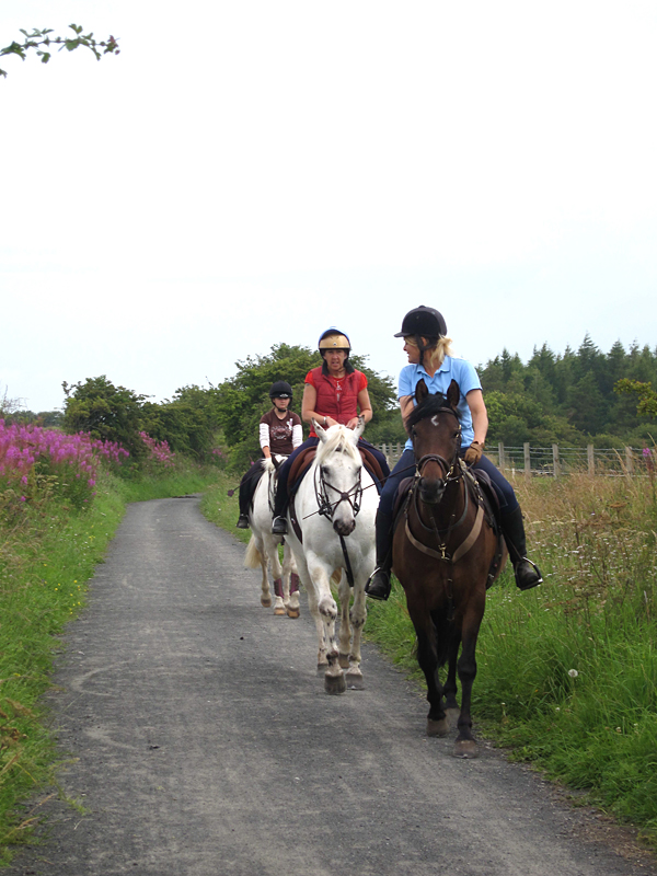
Riders on the bike path near Consett:
Signs before Consett. Which way would be best?:
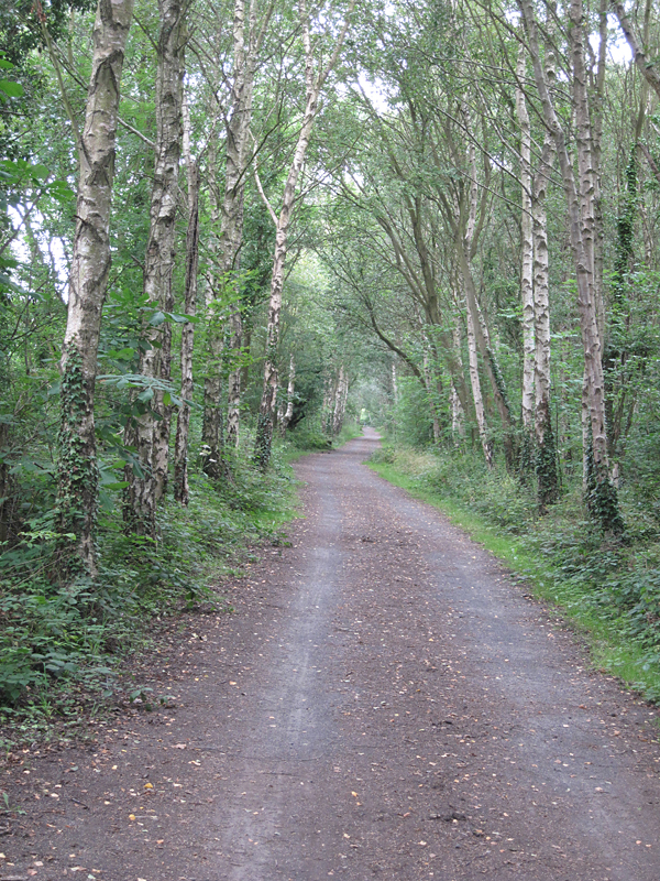
C2C bike path through the woods near Rolands Gill:
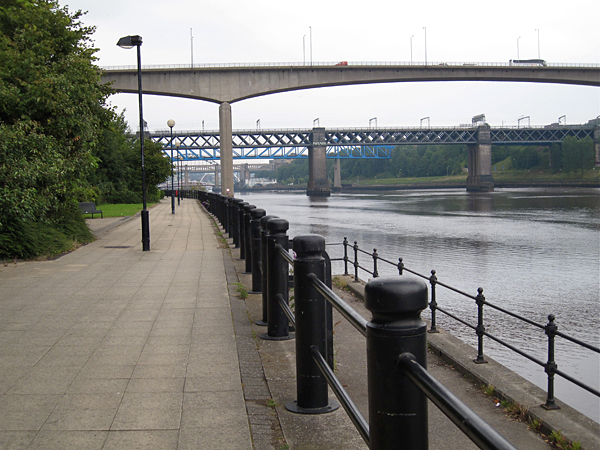
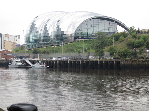
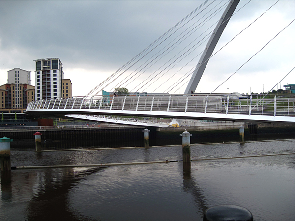
The final section of my ride took place in the Newcastle Upon Tyne metropolitan area. It is gratifying that almost all of this ride is on bike paths. The views from the bike path along the Tyne are always interesting, and even astonishing: The Sage concert hall in Gateshead, designed by Norman Foster, and the Millennium Pedestrian Bridge joining Gateshead and Newcastle, also known as the blinking-eye bridge, designed by architects Wilkinson Eyre.
Entering Newcastle on the bike path:
The Sage consert at Gateshead, above the Tyne River:
The Gateshead-Newcastle Millennium Bridge ia also called the blinking eye bridge, because the ramp raises to the overhead position:
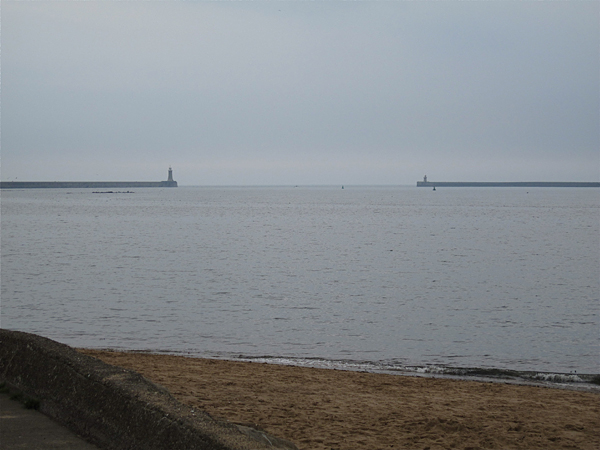
At the North Sea in Tynesmouth, end of the C2C route:
When to go: The best time to cycle in the C2C is from June to September, when it is reasonably warm in the mountains. Depending upon location, precipitation ranges from 50 to 100 millimeters per month (2 to 4 inches). If you have the option, it would be best to time the trip to avoid forecasted rainy spells, and to arrange for flexibility with your lodging arrival dates.
Which direction to ride in: The C2C is almost always ridden from west to east. Why? Supposedly it is because the prevailing wind will be at your back, which could be important at high elevations. Another reason given is that the long section between Parkhead and the North Sea will be on a gentle downhill slope. This is a much more enjoyable way to descend than the sharp drop-offs on the west faces of the Pennines, which would require constant breaking. Perhaps the most compelling reason is "tradition". The map markings and milestones are numbered from west to east.
How to get there: Many British trains carry bicycles. Sometimes a bicycle ticket, for a minimal fee, is required. Sometimes a reservation is required — but if you don't have one you can take a chance at the railway station that the bicycle allotment of a train will not be complete. Obviously, this is best done off season and on week days. Making reservations on-line is complicated and confusing when taking several trains from different companies and bringing a bicycle. The best bet is to go to a railway ticket office.
If you are coming to England from the USA or the Continent, you might fly into London, Manchester, or Liverpool, and fly back from Newcastle. Obviously, few will make the trip from abroad for a bike trip of only a few days. Most will ride the C2C as part of a longer itinerary. Some possible extensions are mentioned below.
How to organize the trip: Organize the trip yourself, let a company organize it for you, or join a guided tour. A list of companies providing services to riders, including guided tours, can be found on this page: http://www.c2c-guide.co.uk/arranged-holidays-2-2/. This site is a commercial operation, and likely the companies listed have paid to be included. At least one of these companies rents hybrid bicycles, and will transport them to the start and from the finish of your tour. If you are organizing the trip yourself, the same person who has the above-mentioned Internet site also publishes the Guide to the C2C which lists most of the accommodations along route. The link is: http://www.c2c-guide.co.uk/shop/. Again, this is a commercial operation, so lodgings may possibly have to pay to be included. I found this guide useful for planning, but not very useful on the ride. The Sustrans map, however, available on the same site and elsewhere, is essential.
Extensions: I had only four days for English cycling, one of which was an unneeded rain day. Many riders will want a longer trip.
Two cycle routes are considered as the "return" of the C2C. These are the "Reivers Route" and "Hadrian's Cycleway." The first runs 176 miles through the wildest and most untouched part of the UK in Northumberland, passing briefly through Scotland, and then through Carlisle. The second, as you might expect, runs 174 miles nearby Hadrian's wall, the northern limit of Roman power in Britain, then also passes through Carlisle. Both routes run from the Tynemouth area to Worthington and Whitehaven. Both are covered in the guidebook mentioned above. I have ridden neither.
Or, you may wish to stray further afield: The Sustrans site, http://www.sustrans.org.uk, has an online map of all the cycle routes in the UK and their connections with one-another. On the home page, under "find a route" enter a name, for example Newcastle, and click "Find". Note that National Route 1 runs up and down the North Sea Coast through Tynesmouth. A good bit north of Newcastle, Route 1 changes its name to the "Coast and Castles Route", which turns inland, and there is also a coastal branch called Route 76 from Spittal. Both of these routes lead to Edinburg, Scotland, in about 175 to 200 miles. Edinburgh is very scenic and worth at least a full day's visit. There are many flights from the Edinburgh airport, and good train connections. You could continue on to Glasgow and the Scottish Highlands.
Or, heading south from Newcastle, you could cycle down to Bridlington via Middlesbrough, Whitby and Scarborough, a good 100 miles; and then take what is perhaps England's second most famous cycle route, the "Way of the Roses" across England, from Sea to Sea, to Morecambe, 171 miles (http://www.sustrans.org.uk/what-we-do/national-cycle-network/long-distance-rides/england/way-of-the-roses). Frequent trains link Morecambe with Blackpool and Liverpool., and both with London.
Tips: "C2C" has meanings beyond the name of this cycle route, such as a English train operating company and various music groups and radio shows. When searching the Internet, add "cycle" to your query.
To learn about British bicycle routes, first consult the Sustrans site, http://www.sustrans.org.uk. I quote from the Internet site of the UK's National Cyclists' Organization:
The National Cycle Network is a comprehensive network of safe and attractive routes to cycle, running throughout the UK. About 12000 miles have been completed, one third of which is on traffic-free paths, the rest follows quiet lanes or traffic-calmed roads. It is delivered through the policies and programmes of over 450 local authorities and other partners, and is co-ordinated by Sustrans, the UK's leading sustainable transport charity.